The Gough Map conservation project
Project dates
2006 – 2009
Project summary
The conservation treatment was undertaken to stabilize the The Gough Map's condition and to attempt to regain some of its material characteristics.
About the Gough Map
The Gough Map, one of the great medieval treasures of cartography, arrived at the Bodleian Library in 1809 as part of Richard Gough's bequest, an eighteenth century antiquary and expert on British Topography. Richard Gough acquired it for half-a-crown on 20 May 1774 at the sale of the collection of Thomas Martin of Palgrave, where it was offered as Lot 405 and described as 'a curious and most ancient map of Great Britain'.
Dated approximately 1360, it is the earliest surviving map to show routes across Britain and to depict a recognisable coastline.
The map, measuring approximately (height) 553mm by (width) 1164mm, is drawn on the flesh-side of two pieces of sheepskin parchment, joined vertically. The lap-join was held together originally with a plain running-stitch, clearly identifiable by sewing-holes and thread-indentations along the join. Indeed, the thread interrupted the application of the green wash which represents the sea, indicating that the sewing was in place before the map was painted. The two parchments are now joined by adhesive only.
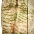
The left-hand skin, seen in transmitted light, has the anatomical features of what appears to be the backbone and ribcage of a lamb.
The map, orientated towards the east, is characterized by vignettes – a building or small group of buildings with red roofs – outlining the towns.
The London vignette is the most elaborate of all, with blue roof, round windows and portcullis in silver leaf, now tarnished, as well as the name and spires in gold leaf.
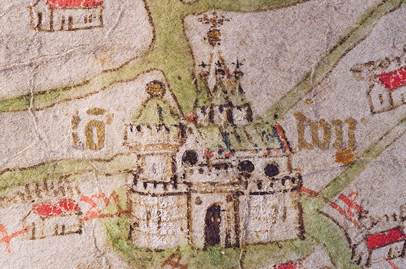
The London vignette is the most elaborate of all, with blue roof, round windows and portcullis in silver leaf, now tarnished, as well as the name and spires in gold leaf.
Many settlements are joined by straight red lines with roman numerals indicating distances. The rivers, of exaggerated size, and the sea are painted separately with two different green hues. In the area north of Hadrian's Wall the representations of the rivers, certain islands, and the fisherman seem to lack outlines. In fact it is the use of a lighter ink, compared with that used for the rest of the map, which gives this whole area an unfinished appearance. Many features on the map are 'pricked'.
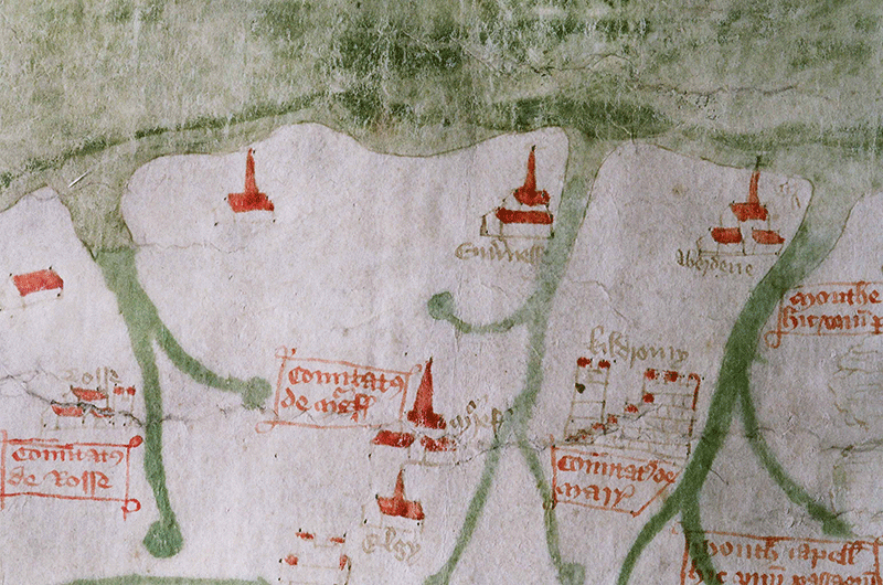
In the area north of Hadrian's Wall the representations of the rivers, certain islands, and the fisherman seem to lack outlines. In fact it is the use of a lighter ink, compared with that used for the rest of the map, which gives this whole area an unfinished appearance.
Condition of the map before treatment
In the past the map has suffered from inadequate storage, display, mounting and repairs. Its pattern of vertical distortion suggests that it had been stored in a rolled format and later pinned to a support, causing a series of rust-stained holes around its perimeter, and displayed almost permanently.
In 1864 an invasive repair of the lacunae took place.
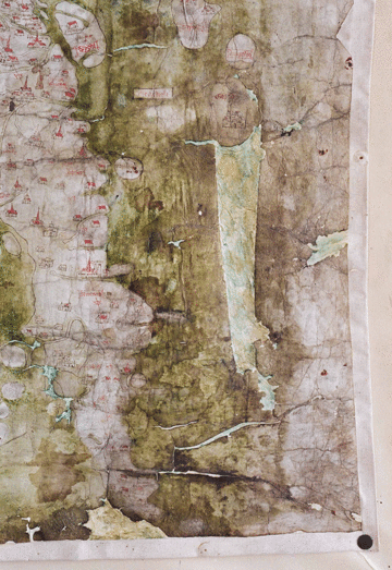
The invasive 1864 repair of the lacunae.
Further distortions of the parchment support and losses of the paint layer occurred after the application of a textile lining.
The examination of the map's surface indicated that although part of the paint layer is damaged, most of what remains is stable. The surface is more abraded and grimed along the areas representing Southern England, in particular the Bristol Channel and the English Channel.
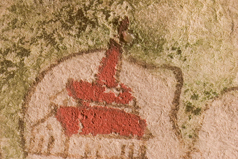
The examination of the map's surface indicated that although part of the paint layer is damaged, most of what remains is stable.
Conservation treatment
The conservation treatment was undertaken to stabilize the map's condition and to attempt to regain some of its material characteristics. The paint layer was stabilized by consolidating friable and flaking areas and enhanced by gently cleaning the surface with soft brushes and white vinyl erasers. The textile lining was removed inserting parting-tools at the edge of the map, where the lining was not adhered to the map due to distortions, and gradually lifted away.
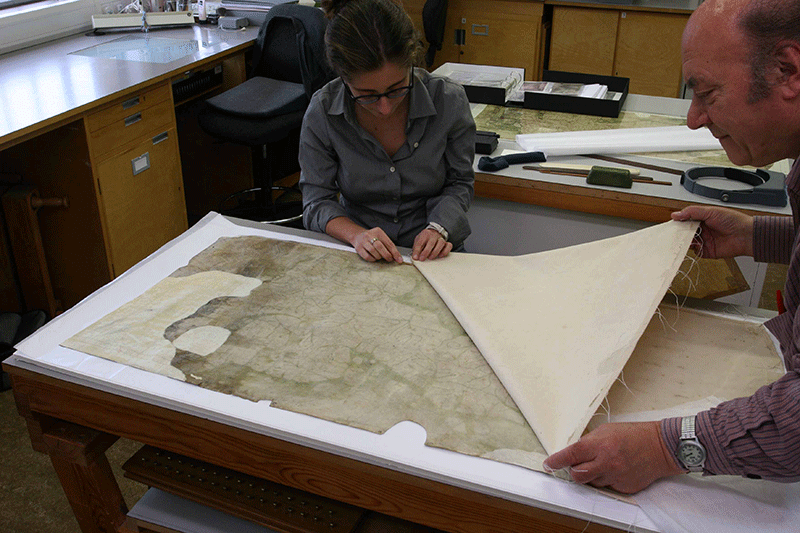
The textile lining was removed inserting parting-tools at the edge of the map, where the lining was not adhered to the map due to distortions, and gradually lifted away.
This treatment started the process of allowing the parchment to regain, in part, its flexibility and original appearance.
The verso, examined for the first time in many years revealed, through a thick layer of adhesive, large patches added in the mid-19th century, which were made from a sheet of unused, red-ruled, sheepskin parchment. Also revealed, was the diamond-shaped paper lot label numbered 405 and the ink inscription 'Old map of Great Britain', evidence of the sale at which Richard Gough purchased the map.
During the next phases of the treatment the map was kept in an environment at around 65% relative humidity so that its condition could be improved. The parchment patches and adhesive residues were removed with spatulas with minimal localised humidification. The lacunae and surrounding fragile areas were then protected with temporary repairs using Japanese paper, applied with wheat starch paste.
The map was humidified locally several times to ease out the many undulations and pleats. New repairs were made, using toned sheepskin parchment applied with a pure gelatine adhesive. Afterwards the whole map was humidified at 75% RH, straightened using clips held with pins on a board, and left to settle slowly reducing the RH to 65%.
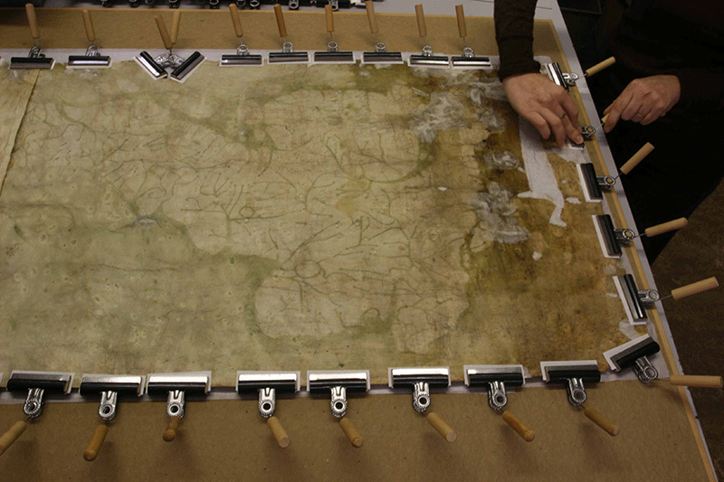
The whole map was humidified at 75% RH, straightened using clips held with pins on a board, and left to settle slowly reducing the RH to 65%.
The map was mounted with linen threads, attached at equal intervals around its edges, on a softly sprung, stainless steel mount within a closely sealed frame of stainless steel and laminated, low-reflectance glass and acrylic, which also will permit examination of the verso.
This sophisticated housing, enclosed by a simple oak over-frame while on exhibition, is an important part of the map's future preservation and security.
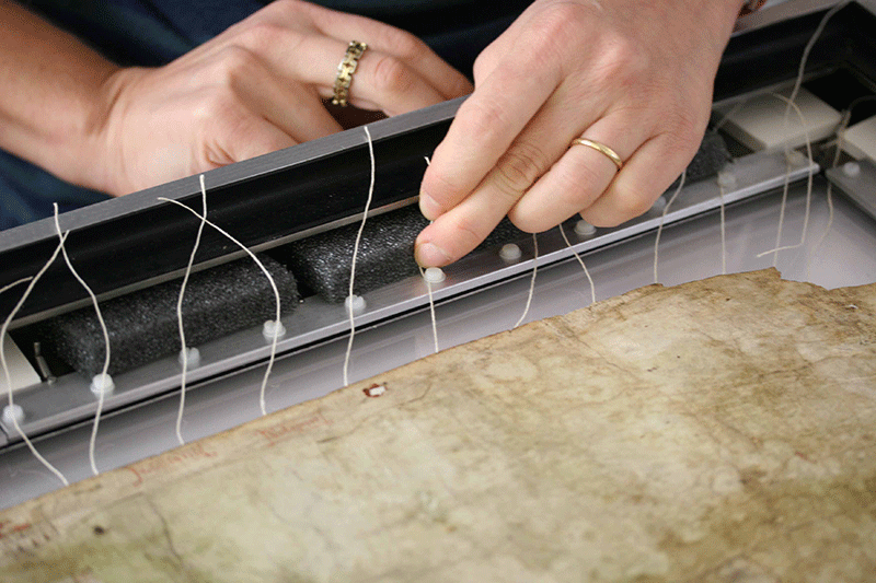
The map is mounted with linen threads, attached at equal intervals around its edges, on a softly sprung, stainless steel mount within a closely sealed frame of stainless steel and laminated, low-reflectance glass and acrylic, which also will permit examination of the verso.
Acknowledgements
The conservation treatment was undertaken between 2006 and 2009 by Christopher Clarkson, consultant to the Bodleian Library, and Marinita Stiglitz, Head of Paper Conservation at the Bodleian Libraries.
Conservation work was made possible thanks to the generosity of Brian Wilson, a member of the Friends of the Bodleian. Mr Wilson's significant donation towards this project is one of many with which he supports conservation at the Bodleian Libraries.

